Cedar Point
- Garfield County - Ticaboo
Trail information
Easy
Loop Trail
No width limit
Dirt Trail
Sand Trail
Single Track
50" Vehicle
S x S
Full Size
NATIONAL PARK SERVICES: General Information: 928.608.6200 Bullfrog Ranger Station: (435) 684.7400 Emergency: (928) 608-6300 Emergency: (800) 582-4351.
Garfield Sheriff’s Office Search and Rescue • (435) 676-2678.
Emergencies: Wayne County Sheriff • (435) 836-1308.
NATIONAL PARK SERVICES: General Information: 928.608.6200 Bullfrog Ranger Station: (435) 684.7400 Emergency: (928) 608-6300 Emergency: (800) 582-4351.
Garfield Sheriff’s Office Search and Rescue • (435) 676-2678.
Emergencies: Wayne County Sheriff • (435) 836-1308.
- trail weather
- Description
It’s not a long trail and can be navigated by riders of any age or experience level and can be completed in a 2-3 hours easily.
This ride could be combined with other trails in the area to fill a weekend.
Maps
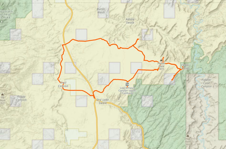
Trail Route

We recommend to download the GAIA App on your mobile device.
You can view and download the route from GAIA as well as see photos with their location geotagged on the trail.
360 Street View
Click “View 360 Map” to explore the trail in Google Street View and “See the Trail Before You Ride the Trail.”
Time Lapse
Download Route
The GPX or KML files are available for you to download and use on your preferred app or device.
Key Points
Within our Key Points you will discover trail head parking, trail markers, points of interests, intersections as well as terrain and obstacles.
Click on the links below to reveal images and information
You will find good signing along this trail. This road is known as ‘ North Turkey Knob Road’.
Cedar Point provides quite a view. In the center of this image, where the small dip appears, is Sunset Pass. You can ride all the way to SunSet Pass and then South to Near Hite.
Check out the Poison Springs to Big Ridge trail.


