Facilities
  OHVs
OHVs Terrain
 Signage
 Emergencies Facilities
 Closest lodging is just west of the trailhead at Zion Mountain Ranch and more options to the east at the Thunderbird Lodge or in the town of Orderville. RV and Tent camping is available at Zion Crest RV park. Just 5 minutes from the trailhead, with additional options at the East Zion RV Park located right at the Mt. Carmel Junction. If you want a more primitive and economical camp site, check out the BLM’s Twin Hollow campground located at this pin drop on Google Maps https://goo.gl/maps/BNPt64tEVEAdDQhT6.
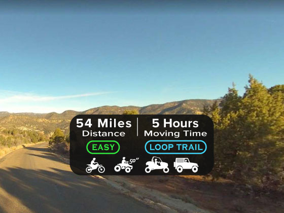
OHVsAll high clearance vehicles are allowed on this route. We would strongly recommend a shorter wheel base on a full size vehicle. ATV and UTV should be fine.
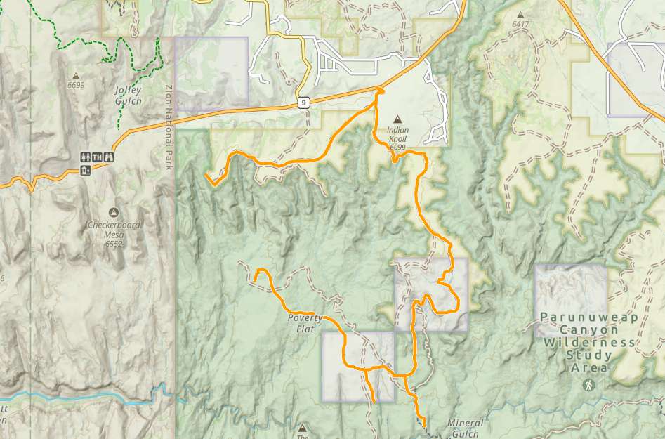
TerrainThe terrain is mostly dirt and sand along ¾ of the trail. The remaining terrain is similar to a typical slick rock, with loose clutter on top. As the trail begins it is usually well maintained and relatively flat, as you start the descent into the Virgin River Canyon the roads become much narrower, and a little more rocky.
SignageThis trail is not well signed and it is advisable to download the route before you take off. There is a Sign and a map board at the trailhead reminding you that you are traveling through a wilderness study area.
EmergenciesThis trail is in Kane County Utah. Emergencies dial 911
Sheriff’s Office: 435-644-2349
Search and Rescue: 435-644-4995
Fire: 435-819-0671
There is a hospital in Kanab 435-644-5811
Sheriff’s Office: 435-644-2349
Search and Rescue: 435-644-4995
Fire: 435-819-0671
There is a hospital in Kanab 435-644-5811
Closest lodging is just west of the trailhead at Zion Mountain Ranch and more options to the east at the Thunderbird Lodge or in the town of Orderville. RV and Tent camping is available at Zion Crest RV park. Just 5 minutes from the trailhead, with additional options at the East Zion RV Park located right at the Mt. Carmel Junction. If you want a more primitive and economical camp site, check out the BLM’s Twin Hollow campground located at this pin drop on Google Maps https://goo.gl/maps/BNPt64tEVEAdDQhT6.
All high clearance vehicles are allowed on this route. We would strongly recommend a shorter wheel base on a full size vehicle. ATV and UTV should be fine.
The terrain is mostly dirt and sand along ¾ of the trail. The remaining terrain is similar to a typical slick rock, with loose clutter on top. As the trail begins it is usually well maintained and relatively flat, as you start the descent into the Virgin River Canyon the roads become much narrower, and a little more rocky.
This trail is not well signed and it is advisable to download the route before you take off. There is a Sign and a map board at the trailhead reminding you that you are traveling through a wilderness study area.
This trail is in Kane County Utah. Emergencies dial 911
Sheriff’s Office: 435-644-2349
Search and Rescue: 435-644-4995
Fire: 435-819-0671
There is a hospital in Kanab 435-644-5811
Sheriff’s Office: 435-644-2349
Search and Rescue: 435-644-4995
Fire: 435-819-0671
There is a hospital in Kanab 435-644-5811