Devils Armchair
- Sevier County - Richfield
Menu
Trail information
Easy
Out & Back
No width limit
Dirt Trail
Sand Trail
Single Track
50" Vehicle
S x S
Full Size
Moving Time
0
hrs
Avg Speed
0
mph
Distance
0
mi
Ascent
0
ft
Descent
0
ft
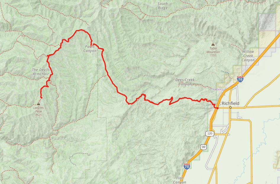
Trail head starts on 300 North and College Avenue in Richfield. Ample trailer parking and Information Kiosk at the Trailhead. Street Legal is not required for this trail although you do travel about 500 yards on paved road. Richfield has 17 motels, a KOA campground, 27 restaurants, 4 Grocery Stores and 17 Gas Stations to choose from.
This trail is open to all off road vehicles.. There are no width restrictions.
The route is mostly compacted dirt with some graded gravel.
Piute Trail System Route Markers on carsonite posts. The trail is well marked Traveling mostly on Piute 01.
Closest medical facilities Sevier Valley Hospital, Richfield: (435) 893-4100.
Utah Highway Patrol: Dial 9-1-1.
Fishlake National Forest Contact: (435) 896-9233.
Sevier County Sheriff: (435) 896-2660.
We highly recommend you purchase a Utah Search and Rescue Assistant Card (USARA), learn more: utah.gov/rescue.
Utah Highway Patrol: Dial 9-1-1.
Fishlake National Forest Contact: (435) 896-9233.
Sevier County Sheriff: (435) 896-2660.
We highly recommend you purchase a Utah Search and Rescue Assistant Card (USARA), learn more: utah.gov/rescue.
- trail weather
Weather Forecast Info can´t be read at the moment!
- Description
The Devils Armchair is named after a large rock formation just off the high point of the route, that juts sharply out of the forested terrain, perched near the mountain top. From the high point of the trail looking west, you can look out into the great basin and perhaps catch a glimpse of the town of Kanosh, and further west is the Sevier Dry Lake.
The trail is an out and back route, meaning that you will return on the same road you went out on. The lower terrain is mostly graded gravel roads up until the route splits for the first time. The terrain turns to mostly compacted mountain dirt with a few occasional rocks protruding from the road bed. The travel is primarily in the Fishlake National Forest so be sure to check on specific travel and camping regulations on their website: fs.usda.gov/fishlake.
The trail is an out and back route, meaning that you will return on the same road you went out on. The lower terrain is mostly graded gravel roads up until the route splits for the first time. The terrain turns to mostly compacted mountain dirt with a few occasional rocks protruding from the road bed. The travel is primarily in the Fishlake National Forest so be sure to check on specific travel and camping regulations on their website: fs.usda.gov/fishlake.
Maps
Trail Route

We recommend to download the GAIA App on your mobile device.
You can view and download the route from GAIA as well as see photos with their location geotagged on the trail.
360 Street View
Click “View 360 Map” to explore the trail in Google Street View and “See the Trail Before You Ride the Trail.”
Download Route
The GPX or KML files are available for you to download and use on your preferred app or device.
Key Points
Within our Key Points you will discover trail head parking, trail markers, points of interests, intersections as well as terrain and obstacles.


