Facilities
  OHVs
OHVs Terrain
 Signage
 Emergencies Facilities
 None, but Vernon has the basics.
OHVsAll sizes. No width limits. ATV’s, MC’s, UTV’s, 4x4s.
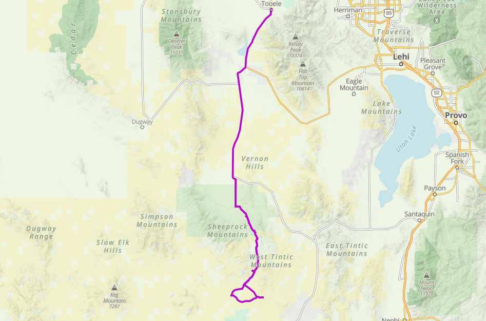
TerrainThe trails follow well-maintained gravel roads so you can expect smooth.
SignageMost Trails have adequate signage.
Maps: Available in Tooele at Steadman’s Recreation.
Maps: Available in Tooele at Steadman’s Recreation.
EmergenciesThe closest medical help is Central Valley Medical Center in Nephi 31 miles south and east on Jericho-Callao Rd across HHY 6 to Rd 132. Dial 911 for Emergencies. 48 W 1500 N, Nephi, UT 84648 (435) 623-3000.
Juab County Sheriff Department Dial 911 or (435) 623-1349.
Tooele County Sheriff Department Dial 911 or (435) 882-5600
Utah Highway Patrol (435) 623-1018
BLM Office at Little Sahara Recreation area (435) 433-5960
Juab County Sheriff Department Dial 911 or (435) 623-1349.
Tooele County Sheriff Department Dial 911 or (435) 882-5600
Utah Highway Patrol (435) 623-1018
BLM Office at Little Sahara Recreation area (435) 433-5960
None, but Vernon has the basics.
All sizes. No width limits. ATV’s, MC’s, UTV’s, 4x4s.
The trails follow well-maintained gravel roads so you can expect smooth.
Most Trails have adequate signage.
Maps: Available in Tooele at Steadman’s Recreation.
Maps: Available in Tooele at Steadman’s Recreation.
The closest medical help is Central Valley Medical Center in Nephi 31 miles south and east on Jericho-Callao Rd across HHY 6 to Rd 132. Dial 911 for Emergencies. 48 W 1500 N, Nephi, UT 84648 (435) 623-3000.
Juab County Sheriff Department Dial 911 or (435) 623-1349.
Tooele County Sheriff Department Dial 911 or (435) 882-5600
Utah Highway Patrol (435) 623-1018
BLM Office at Little Sahara Recreation area (435) 433-5960
Juab County Sheriff Department Dial 911 or (435) 623-1349.
Tooele County Sheriff Department Dial 911 or (435) 882-5600
Utah Highway Patrol (435) 623-1018
BLM Office at Little Sahara Recreation area (435) 433-5960