Currant Creek OHV Trail
- Wasatch County
Menu
Trail information
Easy
Loop Trail
No width limit
Dirt Trail
Sand Trail
Single Track
50" Vehicle
S x S
Full Size
Moving Time
0
hrs
Avg Speed
0
mph
Distance
0
mi
Ascent
0
ft
Descent
0
ft
Vault toilet at the trailhead; kodging, camping, gas and groceries in nearby Heber City or Duchesne. Camping and boating at nearby Strawberry Reservoir. *Some campgrounds may prohibit ATVs.
All sizes. No width limits. ATVs, MCs, UTVs, 4x4s on most trails.
Easy – mostly dirt roads and some parts are gravels
Most trails have adequate signage.
The closest medical help is the Heber Valley Hospital, 454 East Medical Way Heber City, UT 84032. (435) 654-2500 or Uintah Basin Medical Center, 250 W 300 N, Roosevelt, UT 84066 (435) 722-4691
Dial 9-1-1 for emergencies.
Wasatch County Sheriff: Dial 9-1-1 for emergencies or non-emergency dispatch: (435) 654-1411
We highly recommend you purchase a Utah Search and Rescue Assistant Card (USARA), learn more: utah.gov/rescue
Dial 9-1-1 for emergencies.
Wasatch County Sheriff: Dial 9-1-1 for emergencies or non-emergency dispatch: (435) 654-1411
We highly recommend you purchase a Utah Search and Rescue Assistant Card (USARA), learn more: utah.gov/rescue
- trail weather
Weather Forecast Info can´t be read at the moment!
- Description
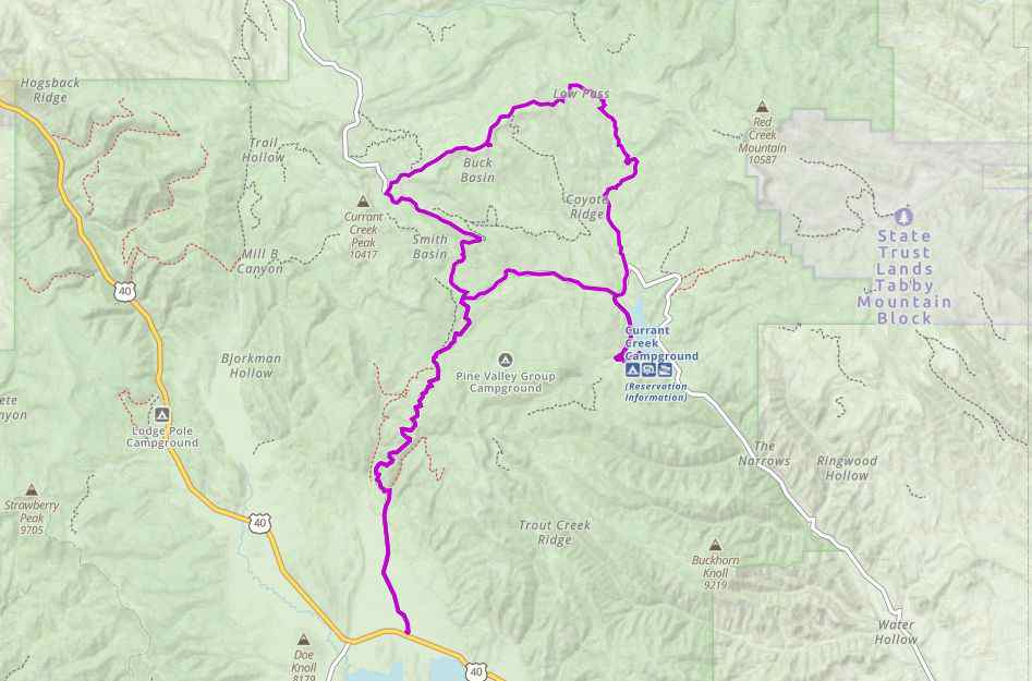
The Currant Creek OHV Trailhead is available seasonally (closed Nov. 1 to June 30th by gate). The trailhead is right off State Route 40 North of Strawberry Reservoir on forest route 082. We spent four hours riding 50 miles of trail at about 13 mph. Plan this trip as a half-day ride or leave some additional time for additional exploration in the area. We’ve included the GPS track and 360 views from the trail below to help you plan your trip.
Maps
Trail Route

We recommend to download the GAIA App on your mobile device.
You can view and download the route from GAIA as well as see photos with their location geotagged on the trail.
360 Street View
Click “View 360 Map” to explore the trail in Google Street View and “See the Trail Before You Ride the Trail.”
Download Route
The GPX or KML files are available for you to download and use on your preferred app or device.
Key Points
Within our Key Points you will discover trail head parking, trail markers, points of interests, intersections as well as terrain and obstacles.
Click on the links below to reveal images and information
There is a large parking area with plenty of room to unload near highway 40. You can see Strawberry Reservoir on the other side of the highway.
Follow the sign for Currant Creek, turning right to continue on forest route 082
Turn right to head to Currant Creek Reservoir and Campground (ATVs are prohibited in the campground). You may see a beaver dam off the road at the north end of the lake. Turning left will take you along the loop we rode.
This looks like a nice campground but be aware ATVs are prohibited in the campground. This is where we turned around.
Turn left here to follow forest route 106.
Looking north toward Death Hollow and Corral Hollow.
Looking southeast Currant Creek Reservoir in the distance.
Riding through the aspens on the way back to highway 40.


