 Facilities
  OHVs
OHVs Terrain
 Signage
 Emergencies Facilities
 Limited, gas and convenience store in Eureka.
OHVsAll sizes. No width limits. ATVs, MCs, UTVs, 4x4s on most trails. There are a few places where you might get some Rocky Mountain pinstriping from junipers reaching into the trail.
TerrainEasy – mostly graded county roads, gravels and a couple rocky sections on the north loop.
SignageThe main routes have adequate signage but there is a fair amount of braiding of the trail through the juniper trees. Keep to the most established routes following GPS.
EmergenciesThe closest medical help is the Central Valley Medical Center, 48 W 1500 N, Nephi, UT 84648 Phone: (435) 623-3000
Dial 9-1-1 for emergencies.
Juab County Sheriff: Dial 9-1-1 or (435) 623-1344 for non emergencies. 425 West Sheeplane Drive, Nephi, UT 84648
Utah Highway Patrol: Dial 9-1-1
We highly recommend you purchase a Utah Search and Rescue Assistant Card (USARA), learn more: utah.gov/rescue
Dial 9-1-1 for emergencies.
Juab County Sheriff: Dial 9-1-1 or (435) 623-1344 for non emergencies. 425 West Sheeplane Drive, Nephi, UT 84648
Utah Highway Patrol: Dial 9-1-1
We highly recommend you purchase a Utah Search and Rescue Assistant Card (USARA), learn more: utah.gov/rescue
Limited, gas and convenience store in Eureka.
All sizes. No width limits. ATVs, MCs, UTVs, 4x4s on most trails. There are a few places where you might get some Rocky Mountain pinstriping from junipers reaching into the trail.
Easy – mostly graded county roads, gravels and a couple rocky sections on the north loop.
The main routes have adequate signage but there is a fair amount of braiding of the trail through the juniper trees. Keep to the most established routes following GPS.
The closest medical help is the Central Valley Medical Center, 48 W 1500 N, Nephi, UT 84648 Phone: (435) 623-3000
Dial 9-1-1 for emergencies.
Juab County Sheriff: Dial 9-1-1 or (435) 623-1344 for non emergencies. 425 West Sheeplane Drive, Nephi, UT 84648
Utah Highway Patrol: Dial 9-1-1
We highly recommend you purchase a Utah Search and Rescue Assistant Card (USARA), learn more: utah.gov/rescue
Dial 9-1-1 for emergencies.
Juab County Sheriff: Dial 9-1-1 or (435) 623-1344 for non emergencies. 425 West Sheeplane Drive, Nephi, UT 84648
Utah Highway Patrol: Dial 9-1-1
We highly recommend you purchase a Utah Search and Rescue Assistant Card (USARA), learn more: utah.gov/rescue
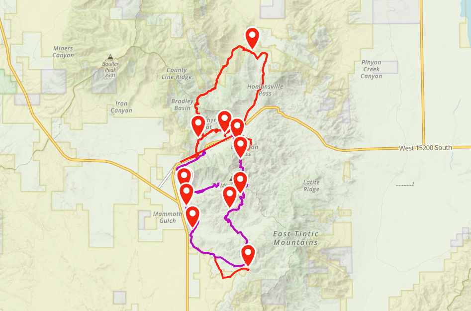
The Cheif Tintic Trail has a North and a South Loop. We started the day unloading at the Euereka City Park and driving across the highway to the South Loop trailhead behind the gas station just east of town.
This is the remnants of the Jesse Knight School. This area is the ghosttown of Knightsville “the only mining camp in the US without a saloon.”Jesse Knight is an interesting figure in the area. We highly suggest you search Jesse Knight Eureka.
What is left of the Humbug Mine. Another interesting piece of the areas history.
Continue on west. This was the site of the Sunbeam Mine.
Looking out over the Dragon Mine.
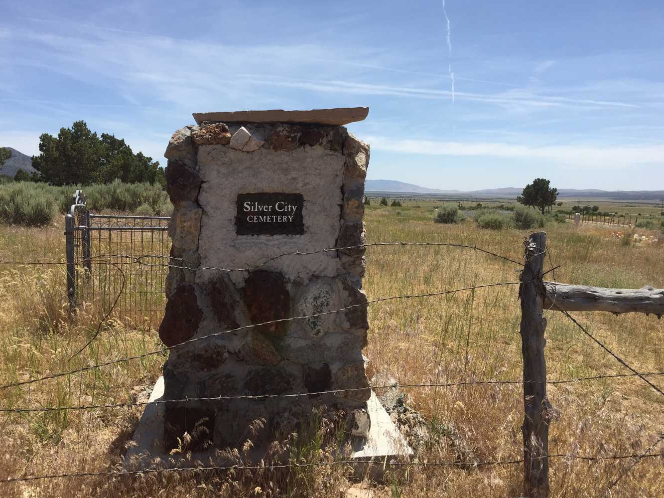
On the way back to Eureka you will come across the Silver City Cemetery.
Stay left here, you will pass a small concrete structure down the trail a ways. Follow the trail that runs parallel to town back to the park. From here you head back to the highway to find the north loop.
This is the trailhead for the north loop. You can access it at the east end of Eureka right off Highway 6. As you can see there is space for parking if you want to stage here.
Stay left here. The other spur dead ends at a Juniper. You will notice there is a fair amount of braiding of the trail through the trees. Do your best to stay on the most established path. There is a gnarly spot coming down the hill with some larger rocks on the other side that will keep the ride interesting. Stay heading north on the trail.

