 Facilities
  OHVs
OHVs Terrain
 Signage
 Emergencies Facilities
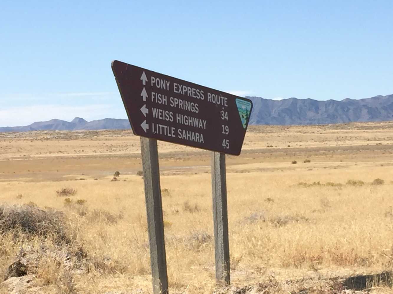
 This ride is OUT in the desert. Let people know where you are going and when you plan to return. Bring plenty of water, food, tools and make sure you have a good spare tire. You can stock up on gas and supplies in Tooele, Eureka, Nephi or Delta (depending on which direction you are coming from). There is a small campground and vault toilet at the Pony Express Historical Marker.
OHVs All sizes. No width limits. ATVs, MCs, UTVs, 4x4s on most trails.
Terrain Easy – Mostly graded county roads with some two-track.
SignageThe main routes have adequate signage but some trails aren’t very clear where they go. This is a good place to have a GPS.
EmergenciesThe closest medical help is Central Valley Medical Center in Nephi, 48 W 1500 N, Nephi, UT 84648. (435) 623-3000. The center is 31 miles south and east on Jericho-Callao Road across HHY 6 to Rd 132. Dial 9-1-1 for emergencies.
Juab County Sheriff Department: Dial 9-1-1 or (435) 623-1349.
Tooele County Sheriff Department: Dial 9-1-1 or (435) 882-5600.
Utah Highway Patrol – Nephi: (435) 623-1018
BLM Office at Little Sahara Recreation area: (435) 433-5960
We highly recommend you purchase a Utah Search and Rescue Assistant Card (USARA). Learn more: utah.gov/rescue
This ride is OUT in the desert. Let people know where you are going and when you plan to return. Bring plenty of water, food, tools and make sure you have a good spare tire. You can stock up on gas and supplies in Tooele, Eureka, Nephi or Delta (depending on which direction you are coming from). There is a small campground and vault toilet at the Pony Express Historical Marker.
All sizes. No width limits. ATVs, MCs, UTVs, 4x4s on most trails.
Easy – Mostly graded county roads with some two-track.
The main routes have adequate signage but some trails aren’t very clear where they go. This is a good place to have a GPS.
The closest medical help is Central Valley Medical Center in Nephi, 48 W 1500 N, Nephi, UT 84648. (435) 623-3000. The center is 31 miles south and east on Jericho-Callao Road across HHY 6 to Rd 132. Dial 9-1-1 for emergencies.
Juab County Sheriff Department: Dial 9-1-1 or (435) 623-1349.
Tooele County Sheriff Department: Dial 9-1-1 or (435) 882-5600.
Utah Highway Patrol – Nephi: (435) 623-1018
BLM Office at Little Sahara Recreation area: (435) 433-5960
We highly recommend you purchase a Utah Search and Rescue Assistant Card (USARA). Learn more: utah.gov/rescue
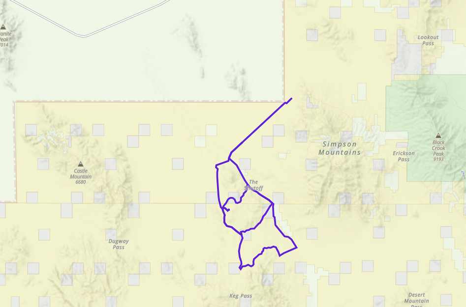
Head southwest from Simpson Springs Station Historic Pony Express Marker. There is a primitive campground nearby if you plan on sleeping out under the stars.
Table Mountain rises from the desert floor 846 feet and an elevation of 5,766 feet.
There are a number of places to explore along the historic Pony Express route. We continue southward toward Table Mountain.
Keep left at the fork.
Stay on the main road here. The two-track to your right eventually disappears into the desert up over the hill. The two-track to the left (north) continues on to Slow Elk Hills but the Flint Spring Road (main road you just left) circles back and around to the same spot.
Turn right and continue heading south at this intersection.
Continue east at this intersection.
You will find a trail that takes off from the main road to your right shortly after the cattleguard.
You will come to another intersection, stay left.
You will come back to the graded road. Continue right (south) on the diagonal to Keg Pass Road. If you watch the track via Ayvri (above) you will see where we circled back to where we originally took off from the main road.
Hang left continuing north at this intersection.
Stay left northwest at this intersection. Continuing on to Simpson Springs Callao Road back to the Pony Express historical marker.

