 Facilities
  OHVs
OHVs Terrain
 Signage
 Emergencies Facilities
 Closest services to the area are about 50 miles away. Stock up on supplies and fuel in Green River, Ferron, Hanksville or Salina (depending on which direction you are traveling from).
OHVsAll sizes. No width limits. ATVs, MCs, UTVs, 4x4s on most trails.
TerrainMostly sandy and some rocky areas.
SignageMost trails have adequate signage.
EmergenciesThe closest medical help is Green River Medical Center, 585 Main Street, Green River, UT 84525. Dial 9-1-1 for emergencies or (435) 564-3434.
If a hospital is required, Castleview Hospital is in Price. 300 North Hospital Drive, Price, UT 84501. Open 24 hours (435) 637-4800.
Utah Highway Patrol – Green River: Dial 9-1-1 or (435) 564-3474
BLM Office in Price: (435) 636-3600
We highly recommend you purchase a Utah Search and Rescue Assistant Card (USARA), learn more: utah.gov/rescue
Closest services to the area are about 50 miles away. Stock up on supplies and fuel in Green River, Ferron, Hanksville or Salina (depending on which direction you are traveling from).
All sizes. No width limits. ATVs, MCs, UTVs, 4x4s on most trails.
Mostly sandy and some rocky areas.
Most trails have adequate signage.
The closest medical help is Green River Medical Center, 585 Main Street, Green River, UT 84525. Dial 9-1-1 for emergencies or (435) 564-3434.
If a hospital is required, Castleview Hospital is in Price. 300 North Hospital Drive, Price, UT 84501. Open 24 hours (435) 637-4800.
Utah Highway Patrol – Green River: Dial 9-1-1 or (435) 564-3474
BLM Office in Price: (435) 636-3600
We highly recommend you purchase a Utah Search and Rescue Assistant Card (USARA), learn more: utah.gov/rescue
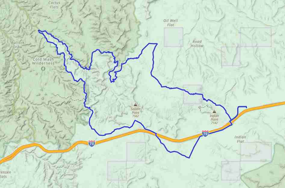
Start out just off I-70 at Buckhorn Draw Road. There is a medium-sized staging area just off the highway.
Head toward Cane Wash. Proceed left at the dead end.
From Cane Wash take Fix-It Pass. Stay to the right at the fork.
Be sure to check out the cool rock formations and ancient caves as you explore through Fix-It Pass.
Stay on North Fork Coal Wash. There are majestic rock formations and sandy trails everywhere you look.
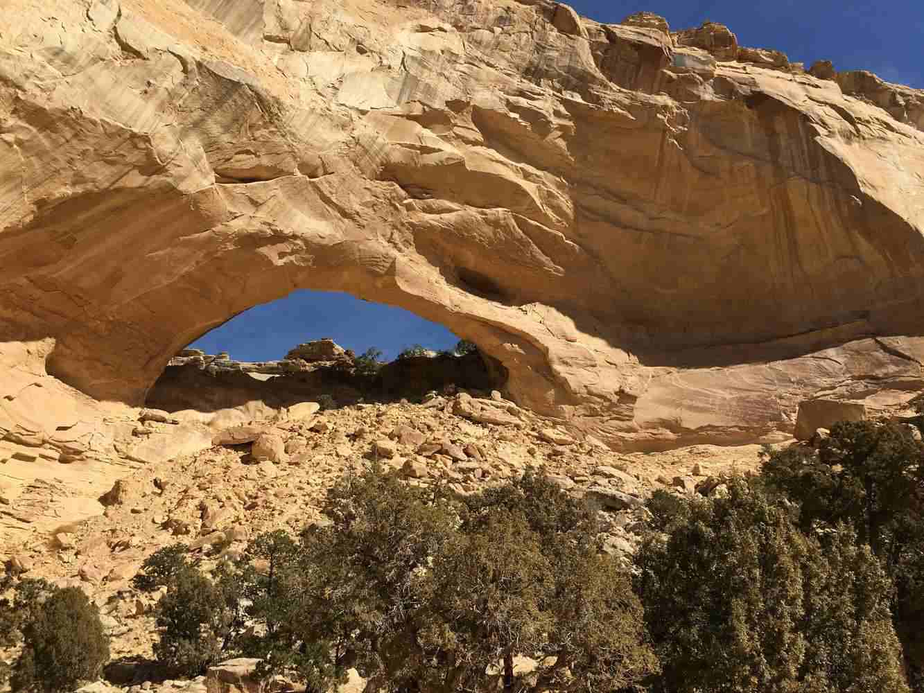
Continue on to Swaseys Arch.
When you see the sign for Sides Mountain and Coal Wash Wilderness area, cross over North Fork Coal Wash and follow the signs to Devil’s Racetrack. Please be sure to stay on the designated trail as you are surrounded by Wilderness Areas, which are closed to motorized recreation.
Gorgeous views and vast overlooks make this ride a truly memorable one.
Be sure to plan some extra time to visit exceptional stops in the area including Dutchman Arch, Locomotive Point and the Head of Sinbad pictographs as you travel back to the trailhead.

