Dry Lake Wash
- Emery County - Green River
Menu
Trail information
Easy
Loop Trail
No width limit
Graded Roads
Sand Trail
rocky Trail
Single Track
50" Vehicle
S x S
Full Size
Moving Time
0
hrs
Avg Speed
0
mph
Distance
0
mi
Ascent
0
ft
Descent
0
ft
Lodging, restaurants, fuel and groceries are all available in Green River. There are no services or rest stops on the trail.
All sizes. No width limits. ATVs, MCs, UTVs, 4x4s on most trails.
Intermediate – Mostly graded county roads with some more technical riding in wash bottoms and sand.
Most trails have adequate signage but this is a good one to use your GPS on (see below).
The closest medical help is Green River Medical Center, 585 Main Street, Green River, UT 84525. Dial 9-1-1 for emergencies or (435) 564-3434. If a hospital is required, Castleview Hospital is in Price. 300 North Hospital Drive, Price, UT 84501. Open 24 hours (435) 637-4800
Emery County Sheriff – Green River: Dial 9-1-1 or (435) 381-2404; Utah Highway Patrol – Green River: Dial 9-1-1 or (435) 564-3474. BLM Office – Price: (435) 636-3600. We highly recommend you purchase a Utah Search and Rescue Assistant Card (USARA), learn more: utah.gov/rescue
Emery County Sheriff – Green River: Dial 9-1-1 or (435) 381-2404; Utah Highway Patrol – Green River: Dial 9-1-1 or (435) 564-3474. BLM Office – Price: (435) 636-3600. We highly recommend you purchase a Utah Search and Rescue Assistant Card (USARA), learn more: utah.gov/rescue
- trail weather
Weather Forecast Info can´t be read at the moment!
- Description
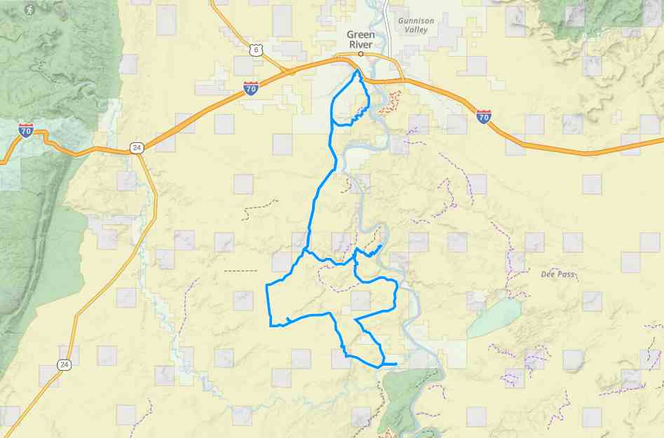
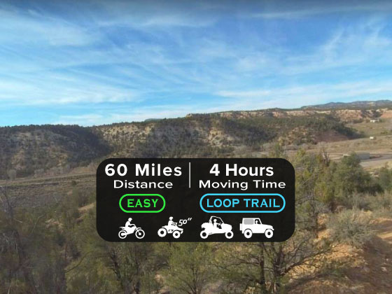
The Dry Lake Wash OHV Trail is a 60-mile, all-day ride in the desert. We spent six hours on the trail at an average speed of 10 mph. Riding consists of graded county roads, sand, and some areas of rocky two-track.
You can base your trip right outside of Green River, right off interstate 70. Green River has options for lodging, restaurants and fuel. This is a great area to ride with access to hundreds of miles of trails and otherworldy desert scenery that makes up the San Rafael Desert.
You can base your trip right outside of Green River, right off interstate 70. Green River has options for lodging, restaurants and fuel. This is a great area to ride with access to hundreds of miles of trails and otherworldy desert scenery that makes up the San Rafael Desert.
Maps
Trail Route

We recommend to download the GAIA App on your mobile device.
You can view and download the route from GAIA as well as see photos with their location geotagged on the trail.
360 Street View
Click “View 360 Map” to explore the trail in Google Street View and “See the Trail Before You Ride the Trail.”
Hyper Lapse
Download Route
The GPX or KML files are available for you to download and use on your preferred app or device.
Key Points
Within our Key Points you will discover trail head parking, trail markers, points of interests, intersections as well as terrain and obstacles.
Click on the links below to reveal images and information
We unloaded just outside of town but you can ride from the hotel to your trailhead if you are street legal.
Riding along the first loop in the trail will take you to an overlook of the Green River. This segment we would consider an intermediate segment because of the rough terrain.
There is some braiding of the trail taking place through here which is why we recommend using GPS on this particular route.
Turn right to head West back to the main County Road 1010 you came in on. If you turn left you will be heading toward Crystal Geyser (but it will be on the opposite side of the Green River).
Make a hard left turn to continue on south. There will be a sign pointing to the route you were just on for Crystal Geyser.
Pretty smooth sailing for a ways on County Road 1010. Watch for oncoming traffic and resist the urge to go too fast.
Stay on County Road 1010 heading south.
You will cross a cattle guard heading south as you enter the badlands.
Head east following the sign for Fossil Point.
You can head north to go check out the Green River or continue on the loop by heading south.
Continuing on north from the last intersection will take you right to the Green River.
Another opportunity for an overlook on the Green River lies to the east.
Turn left to head south at the intersection.
Another geyser or water feature out in the middle of nowhere.
Turn right to head northwest. You are back on County Road 1010, this is your quickest way back to town.


