Facilities
  OHVs
OHVs Terrain
 Signage
 Emergencies Facilities
 No services along the trail. The nearest fuel is in Veyo. The nearby St. George area offers everything you may need for your trip.
OHVsAll sizes. No width limits. ATVs, MCs, UTVs, 4x4s on most trails.
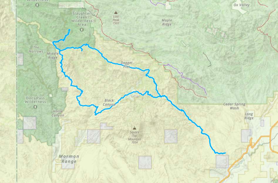
TerrainMostly dirt and gravel roads.
SignageThe area is not signed well. We recommend downloading the GPS track below.
EmergenciesThe closest medical help is St. George Regional Hospital, 1380 E Medical Center Drive, St George, UT 84790. (435) 251-1000. Dial 9-1-1 for emergencies.
Washington County Sheriff: 620 S 5300 W, Hurricane, UT 84737 (435) 656-6500. Dial 9-1-1 for emergencies; Utah Highway Patrol: Dial 9-1-1.
We highly recommend you purchase a Utah Search and Rescue Assistant Card (USARA) learn more: utah.gov/rescue
Washington County Sheriff: 620 S 5300 W, Hurricane, UT 84737 (435) 656-6500. Dial 9-1-1 for emergencies; Utah Highway Patrol: Dial 9-1-1.
We highly recommend you purchase a Utah Search and Rescue Assistant Card (USARA) learn more: utah.gov/rescue
No services along the trail. The nearest fuel is in Veyo. The nearby St. George area offers everything you may need for your trip.
All sizes. No width limits. ATVs, MCs, UTVs, 4x4s on most trails.
Mostly dirt and gravel roads.
The area is not signed well. We recommend downloading the GPS track below.
The closest medical help is St. George Regional Hospital, 1380 E Medical Center Drive, St George, UT 84790. (435) 251-1000. Dial 9-1-1 for emergencies.
Washington County Sheriff: 620 S 5300 W, Hurricane, UT 84737 (435) 656-6500. Dial 9-1-1 for emergencies; Utah Highway Patrol: Dial 9-1-1.
We highly recommend you purchase a Utah Search and Rescue Assistant Card (USARA) learn more: utah.gov/rescue
Washington County Sheriff: 620 S 5300 W, Hurricane, UT 84737 (435) 656-6500. Dial 9-1-1 for emergencies; Utah Highway Patrol: Dial 9-1-1.
We highly recommend you purchase a Utah Search and Rescue Assistant Card (USARA) learn more: utah.gov/rescue