Knightsville Loop
- Juab County - Eureka
- Northern Utah
Menu
Trail information
Easy
Loop Trail
No width limit
Dirt Trail
rocky
Single Track
50" Vehicle
S x S
Full Size
Moving Time
0
hrs
Avg Speed
0
mph
Distance
0
mi
Ascent
0
ft
Descent
0
ft
Food Fuel and a few Air B&Bs are available
Anything will work just fine
Typical mountain dirt roads. Generally smooth with a few ruts and washed areas after heavy rains.
This is part of the Chief Tintic trail system but we didn’t stick to a particular numbered trail.
The closest medical help is the
SANTAQUIN CLINIC
Address
210 East Main Street
Santaquin, UT 84655
The closest Hospital is
Mountain View Hospital Payson
Address
1000 E 100 N, Payson, UT 84651
(801) 465-7000
Dial 9-1-1 for emergencies.
Juab County Sheriff: Dial 9-1-1 or (435) 623-1344 for non emergencies. 425 West Sheeplane Drive, Nephi, UT 84648
Utah Highway Patrol: Dial 9-1-1
We highly recommend you purchase a Utah Search and Rescue Assistant Card (USARA), learn more: utah.gov/rescue
- trail location
- Brought to you by
- trail weather
Weather Forecast Info can´t be read at the moment!
- Description
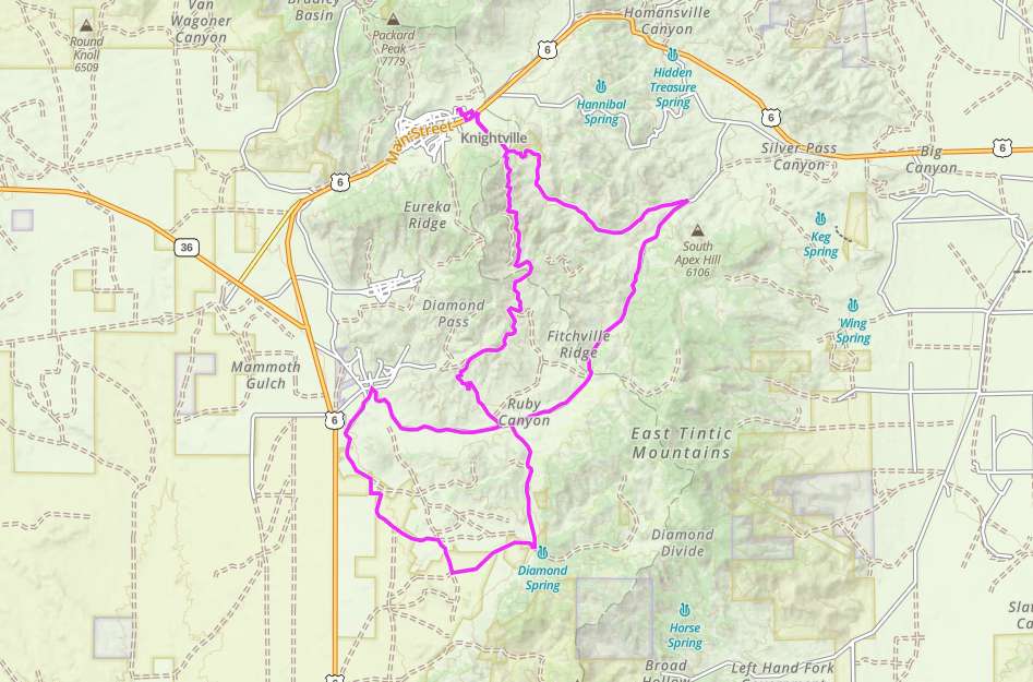
This is a fun loop south of Eureka.
Parking at the City Park is easy for even large rigs, just look for the ‘City Park’ signs on Main Street.
This trail will take you near some of the old mines south of Eureka.
If old graveyards are your thing there is a great one on this trail.
Nothing too difficult, just some fun dirt roads in a big loop with interesting sights along the way.
This is a great place to take a nice Weekend ride, very close to the Wasatch front.
Maps
Trail Route

We recommend to download the GAIA App on your mobile device.
You can view and download the route from GAIA as well as see photos with their location geotagged on the trail.
360 Street View
Click “View 360 Map” to explore the trail in Google Street View and “See the Trail Before You Ride the Trail.”
Time Lapse
Download Route
The GPX or KML files are available for you to download and use on your preferred app or device.
Key Points
Within our Key Points you will discover trail head parking, trail markers, points of interests, intersections as well as terrain and obstacles.


