Facilities
  OHVs
OHVs Terrain
 Signage
 Emergencies Facilities
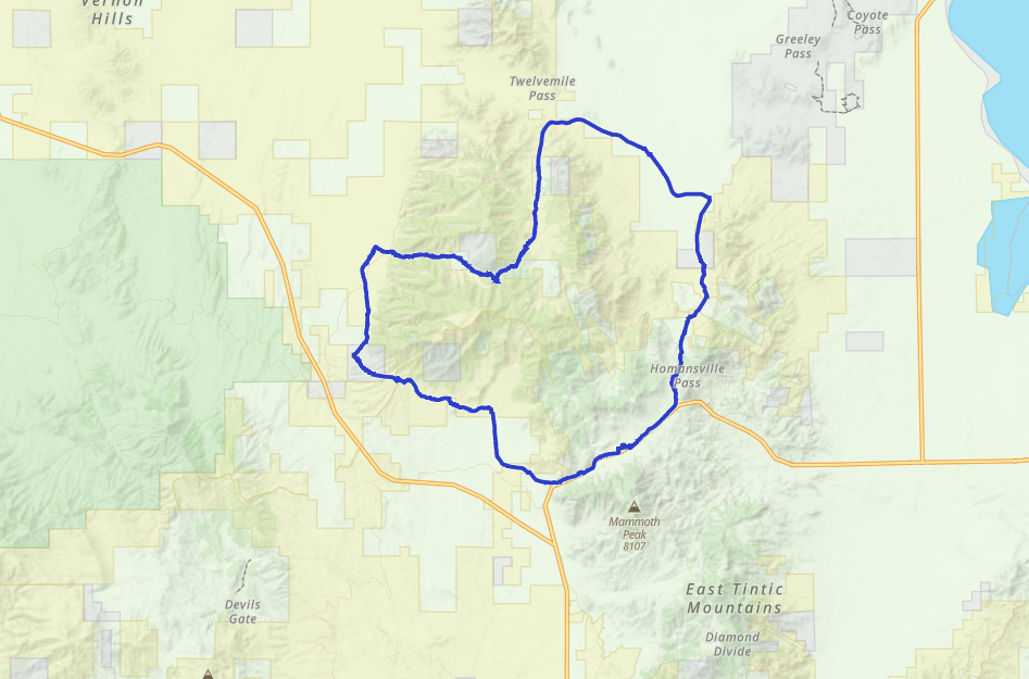
 Eureka!! What a place to ride.
OHVsThis trail will accommodate any size vehicle however the trail get narrow and larger rigs might rub on brush or small limbs.
TerrainThis is an old mining road. It washes out occasionally. You will crertainly find yourself navigating some heavily rutted tail.
SignageNot much in the way of trail signage, Get the GPS track.
EmergenciesThe closest medical help is the
SANTAQUIN CLINIC
Address
210 East Main Street
Santaquin, UT 84655
The closest Hospital is
Mountain View Hospital Payson
Address
1000 E 100 N, Payson, UT 84651
(801) 465-7000
Dial 9-1-1 for emergencies.
Juab County Sheriff: Dial 9-1-1 or (435) 623-1344 for non emergencies. 425 West Sheeplane Drive, Nephi, UT 84648
Utah Highway Patrol: Dial 9-1-1
We highly recommend you purchase a Utah Search and Rescue Assistant Card (USARA), learn more: utah.gov/rescue
Eureka!! What a place to ride.
This trail will accommodate any size vehicle however the trail get narrow and larger rigs might rub on brush or small limbs.
This is an old mining road. It washes out occasionally. You will crertainly find yourself navigating some heavily rutted tail.
Not much in the way of trail signage, Get the GPS track.
The closest medical help is the
SANTAQUIN CLINIC
Address
210 East Main Street
Santaquin, UT 84655
The closest Hospital is
Mountain View Hospital Payson
Address
1000 E 100 N, Payson, UT 84651
(801) 465-7000
Dial 9-1-1 for emergencies.
Juab County Sheriff: Dial 9-1-1 or (435) 623-1344 for non emergencies. 425 West Sheeplane Drive, Nephi, UT 84648
Utah Highway Patrol: Dial 9-1-1
We highly recommend you purchase a Utah Search and Rescue Assistant Card (USARA), learn more: utah.gov/rescue