Facilities
  OHVs
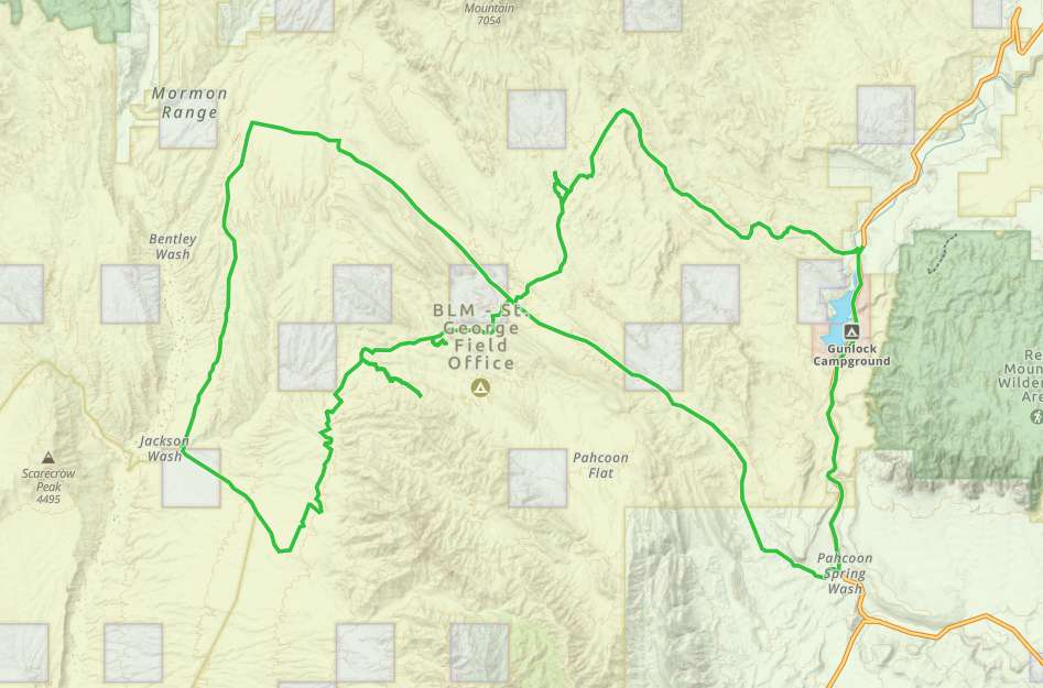
OHVs Terrain
 Signage
 Emergencies Facilities
 Plenty of amenities as you drive through St. George and Santa Clara.
OHVsAll sizes. No width limits. ATVs, MCs, UTVs, 4x4s on most trails.
TerrainRiding would be generalized as easy going graded sandy roads with plenty of dust (this is the desert) and you will see Joshua trees.
Signage Most trails have adequate signage
EmergenciesThe closest medical help is St. George Regional Hospital. 1380 E Medical Center Drive, St George, UT 84790. (435) 251-1000, Dial 9-1-1 for emergencies.
Washington County Sheriff: 620 S 5300 W, Hurricane, UT 84737 (435) 656-6500. Dial 9-1-1 for emergencies.
Utah Highway Patrol: Dial 9-1-1
Washington County Sheriff: 620 S 5300 W, Hurricane, UT 84737 (435) 656-6500. Dial 9-1-1 for emergencies.
Utah Highway Patrol: Dial 9-1-1
Plenty of amenities as you drive through St. George and Santa Clara.
All sizes. No width limits. ATVs, MCs, UTVs, 4x4s on most trails.
Riding would be generalized as easy going graded sandy roads with plenty of dust (this is the desert) and you will see Joshua trees.
Most trails have adequate signage
The closest medical help is St. George Regional Hospital. 1380 E Medical Center Drive, St George, UT 84790. (435) 251-1000, Dial 9-1-1 for emergencies.
Washington County Sheriff: 620 S 5300 W, Hurricane, UT 84737 (435) 656-6500. Dial 9-1-1 for emergencies.
Utah Highway Patrol: Dial 9-1-1
Washington County Sheriff: 620 S 5300 W, Hurricane, UT 84737 (435) 656-6500. Dial 9-1-1 for emergencies.
Utah Highway Patrol: Dial 9-1-1