Facilities
  OHVs
OHVs Terrain
 Signage
 Emergencies Facilities
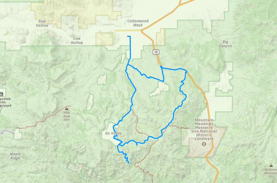
 You start out in the town of Enterprise.
OHVsAll sizes. No width limits. ATV’s, MC’s, UTV’s, 4x4s on most trails. Near the top trails, narrow overgrowth may damage larger vehicles. A few gates seem quite narrow and our Ranger didn’t have a lot of room to spare.
TerrainMostly dirt roads.
SignageMost Trails have adequate signage
EmergenciesThe closest medical help is Enterprise Valley Medical Clinic. 223 S 200 E St, Enterprise, UT 84725. Dial 911 for Emergencies.
Washington County Sheriff Dial 911 or 620 S, 5300 W, Hurricane, UT 84737 (435) 656-6500
Utah Highway Patrol Dial 911
Washington County Sheriff Dial 911 or 620 S, 5300 W, Hurricane, UT 84737 (435) 656-6500
Utah Highway Patrol Dial 911
You start out in the town of Enterprise.
All sizes. No width limits. ATV’s, MC’s, UTV’s, 4x4s on most trails. Near the top trails, narrow overgrowth may damage larger vehicles. A few gates seem quite narrow and our Ranger didn’t have a lot of room to spare.
Mostly dirt roads.
Most Trails have adequate signage
The closest medical help is Enterprise Valley Medical Clinic. 223 S 200 E St, Enterprise, UT 84725. Dial 911 for Emergencies.
Washington County Sheriff Dial 911 or 620 S, 5300 W, Hurricane, UT 84737 (435) 656-6500
Utah Highway Patrol Dial 911
Washington County Sheriff Dial 911 or 620 S, 5300 W, Hurricane, UT 84737 (435) 656-6500
Utah Highway Patrol Dial 911