Facilities
  OHVs
OHVs Terrain
 Signage
 Emergencies Facilities
 Large Fenced Parking Lot, Vault Toilet at Trailhead. There is no fee to park or ride.
OHVs50″ and under ATV’s, UTV’s, MC’s
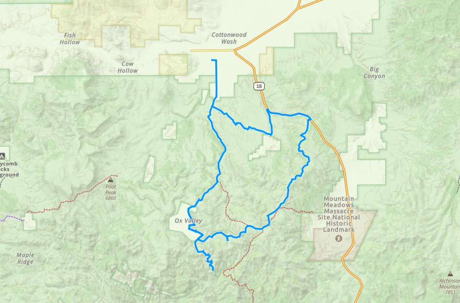
TerrainMostly gravel and dirt roads with some rocky areas.
SignagePlenty of Signage and mileage updates at intersections.
EmergenciesThe closest medical help is Garfield Memorial Hospital only a few due west in Panguitch. 200 N 400 E St, Panguitch, UT 84759 Dial 911 for Emergencies or (435) 676-8811.
Garfield County Sheriff Dial 911 or (435) 676-8811
BLM Office in Kanab Utah (435) 644-1300
Garfield County Sheriff Dial 911 or (435) 676-8811
BLM Office in Kanab Utah (435) 644-1300
Large Fenced Parking Lot, Vault Toilet at Trailhead. There is no fee to park or ride.
50″ and under ATV’s, UTV’s, MC’s
Mostly gravel and dirt roads with some rocky areas.
Plenty of Signage and mileage updates at intersections.
The closest medical help is Garfield Memorial Hospital only a few due west in Panguitch. 200 N 400 E St, Panguitch, UT 84759 Dial 911 for Emergencies or (435) 676-8811.
Garfield County Sheriff Dial 911 or (435) 676-8811
BLM Office in Kanab Utah (435) 644-1300
Garfield County Sheriff Dial 911 or (435) 676-8811
BLM Office in Kanab Utah (435) 644-1300