Facilities
  OHVs
OHVs Terrain
 Signage
 Emergencies Facilities
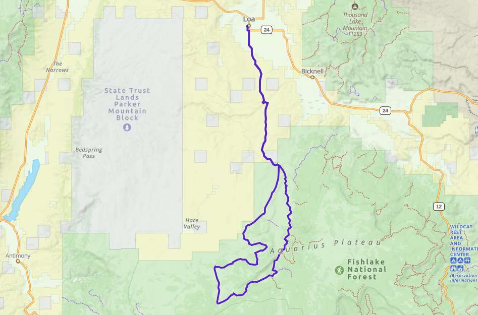
 Starting in Loa gives you plenty of options. We started at the city park a block West of main street. It’s okay to park alongside the the street and there is room for large rigs.
OHVsThe Dark Valley trail will accommodate any size vehicle.
TerrainFast gravel roads give way to relatively smooth trails as you get into the trees and becomes much slower going but no need for 4WD unless there is snow or rain.
SignageThere is limited signage at the beginning of the trail but none further along the trail.
EmergenciesEmergencies dial 911.
Wayne County Sheriff (435) 836-1308
18 S Main St, Loa, UT 84747
Minor Medical
128 S. 300 W.
P.O. Box 303
Bicknell, UT 84715
P: (435) 425-3744 Option 1
F: (435) 425-3785
Monday-Friday 7:00AM-5:00PM
Saturday 9:00AM-1:00PM
Utah Highway Patrol
(Sanpete, Sevier, Piute, Western Wayne Counties) UHP Richfield
835 East 300 North Suite 600
Richfield, Utah 84701
Office: (435) 896-2780
Hours: Monday – Friday
8:00am to 5:00pm
Starting in Loa gives you plenty of options. We started at the city park a block West of main street. It’s okay to park alongside the the street and there is room for large rigs.
The Dark Valley trail will accommodate any size vehicle.
Fast gravel roads give way to relatively smooth trails as you get into the trees and becomes much slower going but no need for 4WD unless there is snow or rain.
There is limited signage at the beginning of the trail but none further along the trail.
Emergencies dial 911.
Wayne County Sheriff (435) 836-1308
18 S Main St, Loa, UT 84747
Minor Medical
128 S. 300 W.
P.O. Box 303
Bicknell, UT 84715
P: (435) 425-3744 Option 1
F: (435) 425-3785
Monday-Friday 7:00AM-5:00PM
Saturday 9:00AM-1:00PM
Utah Highway Patrol
(Sanpete, Sevier, Piute, Western Wayne Counties) UHP Richfield
835 East 300 North Suite 600
Richfield, Utah 84701
Office: (435) 896-2780
Hours: Monday – Friday
8:00am to 5:00pm