Facilities
  OHVs
OHVs Terrain
 Signage
 Emergencies Facilities
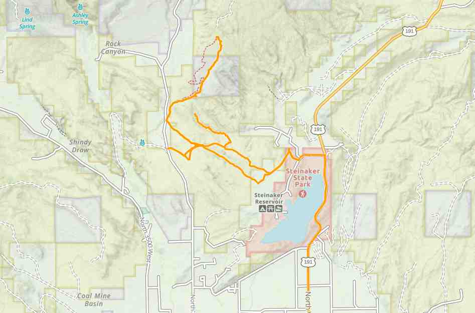
 Steinaker State Park
OHVsAll OHVs: 50″ ATVs, UTVs & MCs and full-sized 4x4s
TerrainMostly sandy and some rocky areas. The trail gets progressively rougher and more difficult as we progress up Red Mountain.
SignageMost Trails have adequate signage
EmergenciesThe closest medical help is Ashley Regional Medical Cente 150 W 100 N, Vernal, UT 84078 Dial 911 for Emergencies or (435) 789-3342
Uintah County Sheriff’s Office 641 E 300 S, Vernal, UT 84078 Dial 911 for Emergencies or (435) 789-2511
Utah Highway Patrol Dial 911 641 East, 300 South, Suite 300
Vernal, Utah 84078 (435) 781-6740
Ashley National Forest 355 North Vernal Avenue Vernal, UT 8407 435-789-1181
Uintah County Sheriff’s Office 641 E 300 S, Vernal, UT 84078 Dial 911 for Emergencies or (435) 789-2511
Utah Highway Patrol Dial 911 641 East, 300 South, Suite 300
Vernal, Utah 84078 (435) 781-6740
Ashley National Forest 355 North Vernal Avenue Vernal, UT 8407 435-789-1181
Steinaker State Park
All OHVs: 50″ ATVs, UTVs & MCs and full-sized 4x4s
Mostly sandy and some rocky areas. The trail gets progressively rougher and more difficult as we progress up Red Mountain.
Most Trails have adequate signage
The closest medical help is Ashley Regional Medical Cente 150 W 100 N, Vernal, UT 84078 Dial 911 for Emergencies or (435) 789-3342
Uintah County Sheriff’s Office 641 E 300 S, Vernal, UT 84078 Dial 911 for Emergencies or (435) 789-2511
Utah Highway Patrol Dial 911 641 East, 300 South, Suite 300
Vernal, Utah 84078 (435) 781-6740
Ashley National Forest 355 North Vernal Avenue Vernal, UT 8407 435-789-1181
Uintah County Sheriff’s Office 641 E 300 S, Vernal, UT 84078 Dial 911 for Emergencies or (435) 789-2511
Utah Highway Patrol Dial 911 641 East, 300 South, Suite 300
Vernal, Utah 84078 (435) 781-6740
Ashley National Forest 355 North Vernal Avenue Vernal, UT 8407 435-789-1181