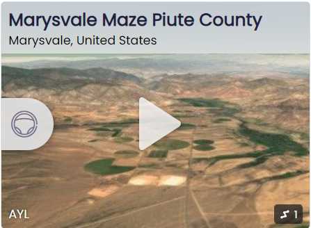
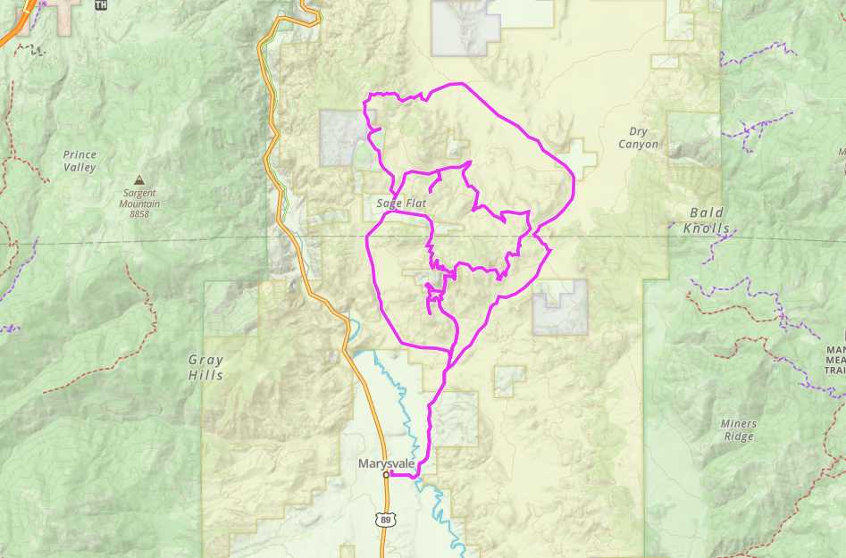
Marysvale Maze OHV Trail

Trail information

Easy

Loop Trail

No width limit

Dirt Trail

rocky Trail

Single Track

50" Vehicle

S x S

Full Size

0 hrs
Moving Time
0 mph
Avg Speed
0 mi
Distance
0 ft
Ascent
0 ft
Descent
Lodging, restaurants, fuel and groceries are all available in Marysvale, Utah.
ATVs, MCs, UTVs, High Clearance 4x4s on all trails. Riding is restricted to designated trails.
Dirt and rock back country roads and trail.
BLM Route Markers and carsonites / well-marked
Sevier Valley Medical Center (Intermountain), 1000 North Main Street, Richfield, UT 84701 (435) 893-4100
Piute County Sheriff : Dial 9-1-1 or (435) 577-2893 • Utah Highway Patrol: Dial 9-1-1.
We highly recommend you purchase a Utah Search and Rescue Assistant Card (USARA) learn more: utah.gov/rescue.
The Marysvale Maze OHV trail will take you on a number of different routes depending on the route you take. There are three different loops that can be taken. Because there are so many forks on the route we took and the terrain looks similar, you will really want to download the GPX file before heading out.

Depending on the route you can visit the Antelope Range with great vistas or visit the old VCA or Prospector mines. We hope this will give you a good preview of a solid ride for beginner to intermediate riders.

Basing out of Marysvale allows for close access to the trailhead to get an early start on the trail without a lot of additional travel.

We spent 4.5 hours riding the trail for 40 miles at approximately 8 mph. You will want to plan on a long day out to allow for plenty of time for getting back.

We rode the trail as an out and back and these numbers are based on taking the full loop. You can shorten the trip by turning on Flat Top Road can cut the trip approximately in half or cutting over the Antelope Range using the VCA Mine Rd and doing 3/4 of the loop.
Maps

Trail Route

Marysvale Maze Trail gaia

We recommend to download the GAIA App on your mobile device.

You can view and download the route from GAIA as well as see photos with their location geotagged on the trail.

360 Street View

Click “View 360 Map” to explore the trail in Google Street View and “See the Trail Before You Ride the Trail.”

Flyover Map

 Experience a bird’s-eye view of the trail to get a better understanding of elevation changes and the surrounding terrain.

Download Route

The GPX or KML files are available for you to download and use on your preferred app or device. 

Key Points

Within our Key Points you will discover trail head parking, trail markers, points of interests, intersections as well as terrain and obstacles.

Click on the links below to reveal images and information

you can stage at Cottonwood Downs – Marysvale City Park.
drive to Bm5831 road.
keep driving in Bm5831 road to this fork. At this point you can explore the trail it’s pretty fun ride. we highly recommend to use Gaia or download the GPX or KML files.
trail video

Coming Soon!

Share The Trail
Facebook
Twitter
LinkedIn
Email
WhatsApp
comments
0.0
Rated 0.0 out of 5
0.0 out of 5 stars (based on 0 reviews)
Excellent0%
Very good0%
Average0%
Below Average0%
Poor0%

There are no comments yet be the first to write one :)

Related Trails

We add new trails every week!

Receive the latest trails, as well as updates on outdoor recreation and off-road events in Utah.
Join our community!

small_c_popup.png

Thank You For Joining Outsiders!!