Facilities
  OHVs
OHVs Terrain
 Signage
 Emergencies Facilities
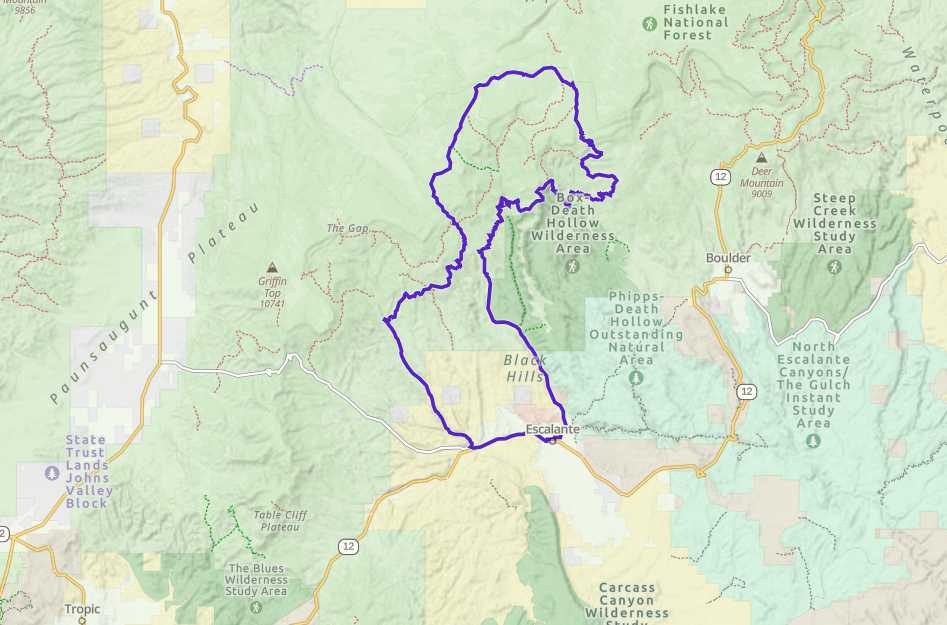
 Lodging, restaurants, fuel and groceries are available in the town of Escalante. Facilities along the trail are sparse, but there are two campgrounds you can stop at.
OHVsMostly dirt and gravel roads. Small stretch of OHV trail-style riding.
TerrainMostly paved and dirt roads.
Signagesigns at most intersections noting distance to landmarks and direction of travel.
EmergenciesGarfield Memorial Hospital in Panguitch – 200 N 400 E St, Panguitch, UT 84759
Garfield County Sheriff: Dial 9-1-1 for emergencies or Non-Emergency Dispatch: 435-676-2678.
We highly recommend you purchase a Utah Search and Rescue Assistant Card (USARA) learn more: utah.gov/rescue
Garfield County Sheriff: Dial 9-1-1 for emergencies or Non-Emergency Dispatch: 435-676-2678.
We highly recommend you purchase a Utah Search and Rescue Assistant Card (USARA) learn more: utah.gov/rescue
Lodging, restaurants, fuel and groceries are available in the town of Escalante. Facilities along the trail are sparse, but there are two campgrounds you can stop at.
Mostly dirt and gravel roads. Small stretch of OHV trail-style riding.
Mostly paved and dirt roads.
signs at most intersections noting distance to landmarks and direction of travel.
Garfield Memorial Hospital in Panguitch – 200 N 400 E St, Panguitch, UT 84759
Garfield County Sheriff: Dial 9-1-1 for emergencies or Non-Emergency Dispatch: 435-676-2678.
We highly recommend you purchase a Utah Search and Rescue Assistant Card (USARA) learn more: utah.gov/rescue
Garfield County Sheriff: Dial 9-1-1 for emergencies or Non-Emergency Dispatch: 435-676-2678.
We highly recommend you purchase a Utah Search and Rescue Assistant Card (USARA) learn more: utah.gov/rescue