Burbank Hills OHV Trail
- Millard County
Menu
Trail information
Easy
Loop Trail
No width limit
prairie
Single Track
50" Vehicle
S x S
Full Size
Moving Time
0
hrs
Avg Speed
0
mph
Distance
0
mi
Ascent
0
ft
Descent
0
ft
None
All sizes. No width limits. ATV’s, MC’s, UTV’s, 4x4s
Prairie
Most Trails have adequate signage.
Maps: Available in Delta at the Millard County Tourism office 75W Main.
Maps: Available in Delta at the Millard County Tourism office 75W Main.
The closest medical help is Milford Hospital 23 miles south on HWY 257. Dial 911 for Emergencies.
Millard County Sheriff 911 or (435) 864-2755 or (435) 743-6223
Utah Highway Patrol (435) 743-6653
BLM Office in Fillmore (435)743-3123
Millard County Sheriff 911 or (435) 864-2755 or (435) 743-6223
Utah Highway Patrol (435) 743-6653
BLM Office in Fillmore (435)743-3123
- trail weather
Weather Forecast Info can´t be read at the moment!
- Description
The Burbank Hills OHV trails are located in Millard County Utah approximately 80 miles west of Delta, has several Trailheads with good parking areas located off Utah Hwy 50 between Delta and the Utah-Nevada State Line and along Hwy 21. There are approximately 98 miles of trails and gravel roads in this trail system. We chose the trailhead just south of the small town of Garrison near Pruess Lake on Hwy 21. This might not be the best place if you have a large vehicle and plan to spend the night. You may encounter a few cows and their owners but few people.
Garrison has no services so stock up on anything you need before leaving Delta (or Milford if you are coming from the South) This is a great place to get away and enjoy some solitude while exploring a seldom seen part of Utah. The riding is pleasant and scenic, relatively smooth trails and a great place for new riders to enjoy their learning experience.
Garrison has no services so stock up on anything you need before leaving Delta (or Milford if you are coming from the South) This is a great place to get away and enjoy some solitude while exploring a seldom seen part of Utah. The riding is pleasant and scenic, relatively smooth trails and a great place for new riders to enjoy their learning experience.
Maps
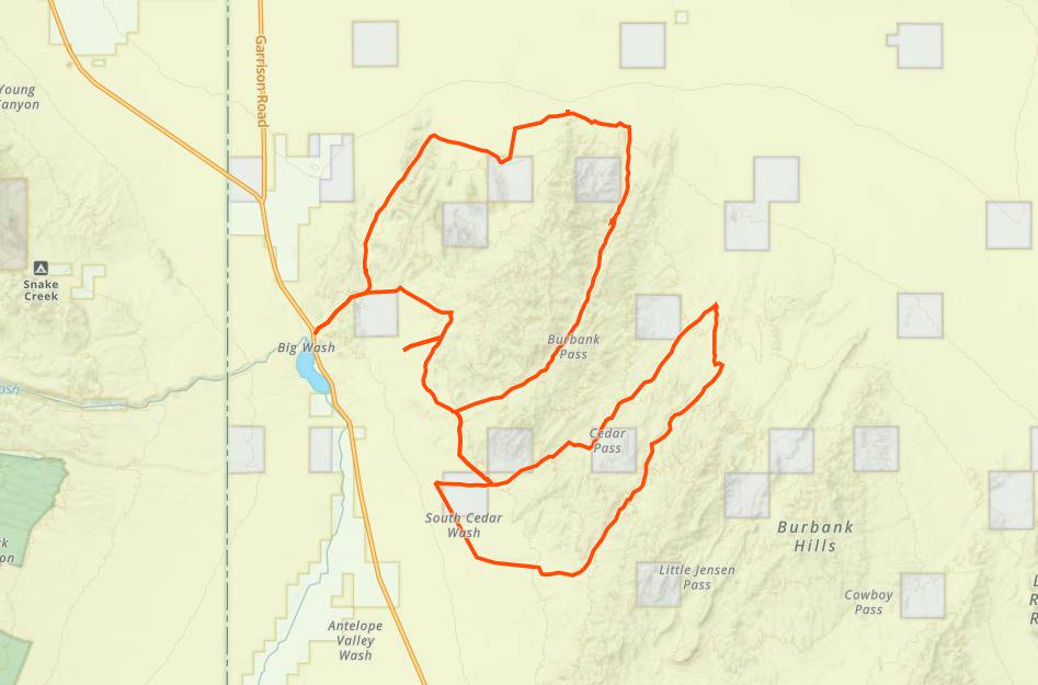
Trail Route

We recommend to download the GAIA App on your mobile device.
You can view and download the route from GAIA as well as see photos with their location geotagged on the trail.
360 Street View
Click “View 360 Map” to explore the trail in Google Street View and “See the Trail Before You Ride the Trail.”
Download Route
The GPX or KML files are available for you to download and use on your preferred app or device.
Key Points
Within our Key Points you will discover trail head parking, trail markers, points of interests, intersections as well as terrain and obstacles.
Click on the links below to reveal images and information
If you happen to see a rancher watering his cows wave and please be careful, keeping speed way down as you go past the herd.
It appears a new fence has been built since early GPS Tracks of the trail were created. No worries you will just need to make a little jog a few hundred feet north and you will find this gate. Like always, go through and leave the gate as you found it. If it is closed when you arrive it should be closed when you leave. Please follow this rule. Local ranchers work hard enough without spending days gathering cows because we forgot to close the gate.
Note how little snow there in on December 19th. We are approaching the high point of this trail.
Again at a higher elevation, still quite passable.


