Bridger Jack Mesa Trail
- San Juan County
Trail information
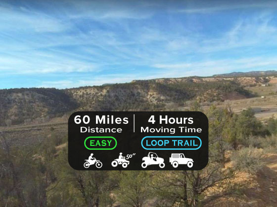
Easy
Loop Trail
No width limit
Dirt Trail
Sand Trail
Single Track
50" Vehicle
S x S
Full Size
Maps: Available in Delta at the Millard County Tourism office 75W Main.
Millard County Sheriff 911 or (435) 864-2755 or (435) 743-6223
Utah Highway Patrol (435) 743-6653
BLM Office in Fillmore (435)743-3123
Maps: Available in Delta at the Millard County Tourism office 75W Main.
Millard County Sheriff 911 or (435) 864-2755 or (435) 743-6223
Utah Highway Patrol (435) 743-6653
BLM Office in Fillmore (435)743-3123
- trail weather
Bridger Jack Mesa Trail
clear sky
07:03
|
19:40
Temp: 33 / 33 / 57 ℉
|
Wind: 7 mph
|
Clouds: 0 %
...HIGH WIND WATCH IN EFFECT FROM MONDAY MORNING THROUGH MONDAY EVENING... * WHAT...Southwest winds 30 to 40 mph with gusts up to 60 mph possible. * WHERE...In Colorado, Grand Valley, Central Gunnison and Uncompahgre River Basin, Uncompahgre Plateau and Dallas Divide, Paradox Valley/Lower Dolores River, Four Corners/Upper Dolores River and Animas River Basin. In Utah, Southeast Utah, Arches/Grand Flat, La Sal and Abajo Mountains and Canyonlands/Natural Bridges. * WHEN...From Monday morning through Monday evening. * IMPACTS...Damaging winds could blow down trees and power lines. Power outages are possible. Travel could be difficult, especially for high profile vehicles.
(NWS GrandJunction (Western Colorado and Eastern Utah))
Bridger Jack Mesa Trail
clear sky
07:02
|
19:41
Temp: 42 / 57 / 59 ℉
|
Wind: 28 mph
|
Clouds: 8 %
...HIGH WIND WATCH IN EFFECT FROM MONDAY MORNING THROUGH MONDAY EVENING... * WHAT...Southwest winds 30 to 40 mph with gusts up to 60 mph possible. * WHERE...In Colorado, Grand Valley, Central Gunnison and Uncompahgre River Basin, Uncompahgre Plateau and Dallas Divide, Paradox Valley/Lower Dolores River, Four Corners/Upper Dolores River and Animas River Basin. In Utah, Southeast Utah, Arches/Grand Flat, La Sal and Abajo Mountains and Canyonlands/Natural Bridges. * WHEN...From Monday morning through Monday evening. * IMPACTS...Damaging winds could blow down trees and power lines. Power outages are possible. Travel could be difficult, especially for high profile vehicles.
(NWS GrandJunction (Western Colorado and Eastern Utah))
Bridger Jack Mesa Trail
rain and snow
07:00
|
19:42
Temp: 34 / 59 / 61 ℉
|
Wind: 42 mph
|
Clouds: 11 %
...HIGH WIND WATCH IN EFFECT FROM MONDAY MORNING THROUGH MONDAY EVENING... * WHAT...Southwest winds 30 to 40 mph with gusts up to 60 mph possible. * WHERE...In Colorado, Grand Valley, Central Gunnison and Uncompahgre River Basin, Uncompahgre Plateau and Dallas Divide, Paradox Valley/Lower Dolores River, Four Corners/Upper Dolores River and Animas River Basin. In Utah, Southeast Utah, Arches/Grand Flat, La Sal and Abajo Mountains and Canyonlands/Natural Bridges. * WHEN...From Monday morning through Monday evening. * IMPACTS...Damaging winds could blow down trees and power lines. Power outages are possible. Travel could be difficult, especially for high profile vehicles.
(NWS GrandJunction (Western Colorado and Eastern Utah))
- Description
Maps
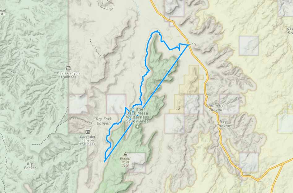
Trail Route

We recommend to download the GAIA App on your mobile device.
You can view and download the route from GAIA as well as see photos with their location geotagged on the trail.
360 Street View
Click “View 360 Map” to explore the trail in Google Street View and “See the Trail Before You Ride the Trail.”
Download Route
The GPX or KML files are available for you to download and use on your preferred app or device.
Key Points
Within our Key Points you will discover trail head parking, trail markers, points of interests, intersections as well as terrain and obstacles.
Click on the links below to reveal images and information
Luckily the only exit from the West side of Bridger Jack Mesa is on a Class B maintained County road that makes a quick but scenic trip back to the Trailhead.
Here we are on the graded gravel road. Just follow it to the left and it will take you right back around to the trailhead. If you go right to Beef Basin you could eventually cross West Mountain and drop into either Monticello or Blanding. We’ll save that for another day.