Amasa Basin OHV Trail
- Millard County
Menu
Trail information
Difficult
Loop Trail
No width limit
Dirt Trail
Sand Trail
Single Track
50" Vehicle
S x S
Full Size
Moving Time
0
hrs
Avg Speed
0
mph
Distance
0
mi
Ascent
0
ft
Descent
0
ft
Vault Toilet at Trailhead only.
All sizes. No width limits. ATV’s, MC’s, UTV’s, 4x4s on most trails. Near the top trails, narrow overgrowth may damage larger vehicles.
Sandy and dirt roads. Mostly easy with some difficult parts.
Most Trails have adequate signage.
Maps: Available in Delta at the Millard County Tourism office 75W Main.
Maps: Available in Delta at the Millard County Tourism office 75W Main.
The closest medical help is Milford Hospital 23 miles south on HWY 257. Dial 911 for Emergencies.
Millard County Sheriff 911 or (435) 864-2755 or (435) 743-6223
Utah Highway Patrol (435) 743-6653
BLM Office in Fillmore (435)743-3123
Millard County Sheriff 911 or (435) 864-2755 or (435) 743-6223
Utah Highway Patrol (435) 743-6653
BLM Office in Fillmore (435)743-3123
- trail weather
Weather Forecast Info can´t be read at the moment!
- Description
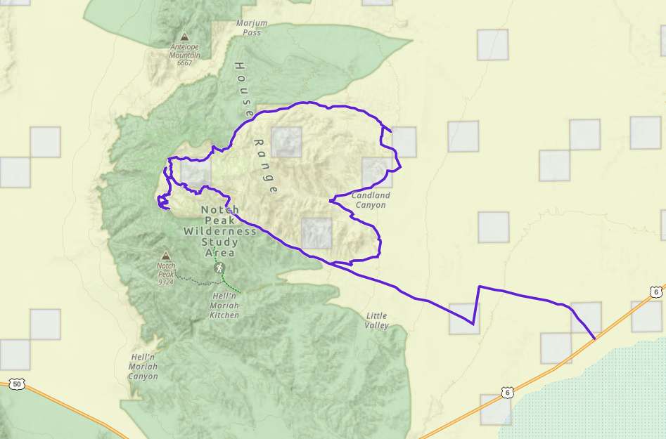
The Amasa Basin OHV trails are located in Millard County Utah approximately 51 miles west of Delta, with good parking located off Utah Hwy 50. There are approximately 33 miles of trails and gravel roads in this trail system. It will take you all day to explore this system and it is well worth the trip. There is a large sinkhole (stay outside the fence) and the view from the top is identical to that from Notch Peak without the 8-mile hike.
There are no services so stock up on anything you need before leaving Delta (or Milford if you are coming from the South) This is a great place to get away and enjoy some solitude while exploring a seldom seen part of Utah.
The riding is pleasant and scenic, trails vary from easy to difficult. Trust the trail ratings. The black trails are not for beginners. We descended from the top on Trail 6 and while the map shows it as a blue trail you will find the markers on the ground have it as black. It has some very tricky sections even going downhill, that may not be passable without winching going uphill.
Maps
Trail Route

We recommend to download the GAIA App on your mobile device.
You can view and download the route from GAIA as well as see photos with their location geotagged on the trail.
360 Street View
Click “View 360 Map” to explore the trail in Google Street View and “See the Trail Before You Ride the Trail.”
Download Route
The GPX or KML files are available for you to download and use on your preferred app or device.
Key Points
Within our Key Points you will discover trail head parking, trail markers, points of interests, intersections as well as terrain and obstacles.
Click on the links below to reveal images and information
It won’t take you long to move up in elevation and the scrub brush turns to Pinion Pine trees and Juniper.
Then the Pinions turn to giant boulders and a few more leaves.
From the top of the mountain, the view is endless.
The trail narrows and is heavily washed out with many large boulders to work your way around. Beginners may want to skip this short section.
The trail ahead is not for expert riders only.
The trail ends at the edge of a Wilderness Study Area. We walked from here. It is possible to hike across to Notch Peak from here.
If you choose to return on Trail #6 be aware that it narrows significantly and heavily scrubbed both sides of our 50″ RZR. A larger rig could suffer significant paint or trim damage.
While this section is rough, rocky, narrow and slow, the views are spectacular.
The last leg returning to the Trailhead is wide and smooth, a nice reprieve.


