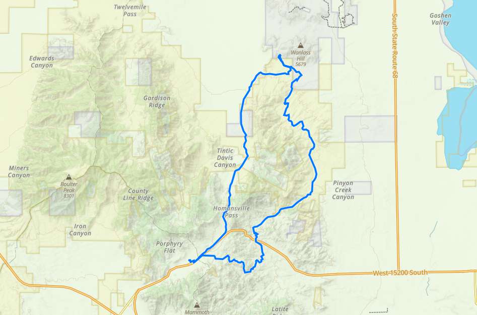
Little Moab Homansville Pass Loop
- Juab County - Eureka
- Northern Utah
Menu
Trail information
Easy
Loop Trail
No width limit
Dirt Trail
Rocky
Single Track
50" Vehicle
S x S
Full Size
Moving Time
0
hrs
Avg Speed
0
mph
Distance
0
mi
Ascent
0
ft
Descent
0
ft
Eureka has Fuel, a few Restaurants and some Air B&B’s but no Hotels.
Any size vehicle will do well on this trail.
Most of the trail is smooth dirt road, the “Little Moab” area is well known to have some serious rock crawling but you can easily pick and choose to fit your machine and experience level and even avoid the large obstacles all together if you prefer.
There are a few trail signs as part of the Chief Tintic Trail system but this trail does not follow any particular numbered trail so get the GPS track.
The closest medical help is the
SANTAQUIN CLINIC
Address
210 East Main Street
Santaquin, UT 84655
The closest Hospital is
Mountain View Hospital Payson
Address
1000 E 100 N, Payson, UT 84651
(801) 465-7000
Dial 9-1-1 for emergencies.
Juab County Sheriff: Dial 9-1-1 or (435) 623-1344 for non emergencies. 425 West Sheeplane Drive, Nephi, UT 84648
Utah Highway Patrol: Dial 9-1-1
We highly recommend you purchase a Utah Search and Rescue Assistant Card (USARA), learn more: utah.gov/rescue
- trail location
- Brought to you by
- trail weather
Weather Forecast Info can´t be read at the moment!
- Description
Some of the best riding, so close to the Wasatch Front!!
Eureka has a long mining history, and as a result, a lot of old mining roads.
This trail will take you from downtown Eureka south where you will see some of the old mines and then back north to “Little Moab”.
Little Moab is a favorite rock crawling area with a little bit to off everyone. From easy to really hard this is a great place to hone your rock crawling skills and get a feel for how your machine handles rock. You will be surprised at how much traction you get on these rocky mounds.
Perfect for a quick day out if you live in Northern Utah.
Maps
Trail Route

We recommend to download the GAIA App on your mobile device.
You can view and download the route from GAIA as well as see photos with their location geotagged on the trail.
360 Street View
Click “View 360 Map” to explore the trail in Google Street View and “See the Trail Before You Ride the Trail.”
Flyover Map
Experience a bird’s-eye view of the trail to get a better understanding of elevation changes and the surrounding terrain.
Download Route
The GPX or KML files are available for you to download and use on your preferred app or device.
Key Points
Within our Key Points you will discover trail head parking, trail markers, points of interests, intersections as well as terrain and obstacles.
Click on the links below to reveal images and information
We started in Eureka


