We want people to explore all of Utah, not just the well-known places. Our trail pages are designed to help the OHV and ATV rider discern a specific route out of the maze of tracks, trails and roads throughout the state. We want it to be effortless to plan and navigate an area, so that you have an enjoyable and memorable trip. On Outsiders Utah, you’ll find the route GPS, emergency support, geological data, and historic treasures of the trail, as told by the locals.
Outsiders Utah is the result of the efforts of the Trail 360 Project, a collaboration between the Utah OHV program, At Your Leisure and several gateway communities to Utah’s motorized backcountry. The Trail 360 Project started with a meeting between Chris Haller, who was at the time the OHV Program Coordinator and Shannon Bushman, a well-known rider and OHV event organizer trying to find a way to get people out on the lesser known trails in the state.
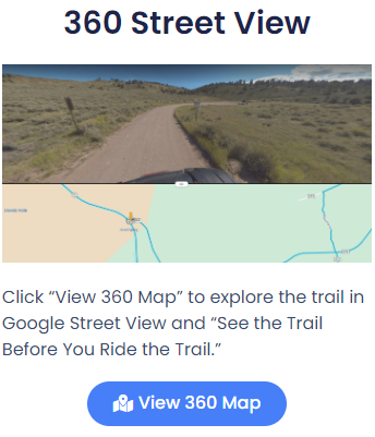
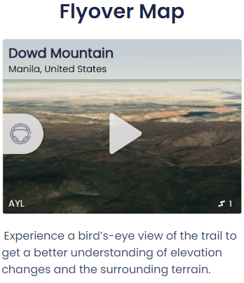
The contention was that people weren’t willing to adventure to new places because they were uncertain what they would encounter after they had driven miles to get there. By using his background in computers and marketing, Shannon was able to tap into existing virtual technologies. Time lapse video and Google Street View, coupled with GPS data provide all the details that people need to plan a trip. It was felt that if a person could get a clear “on the ground” picture of what a ride had in store for them, they would gain enough certainty to overcome their fear and venture out to new areas.
How To
Trail Info
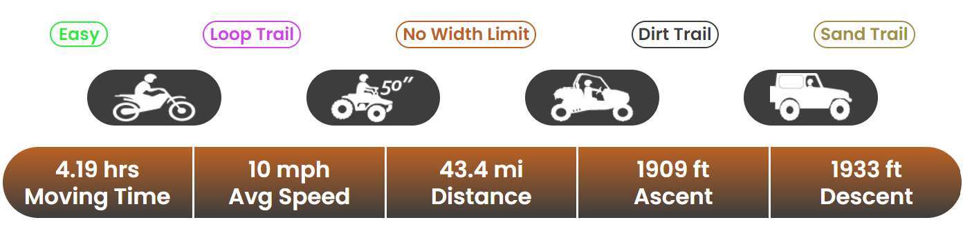
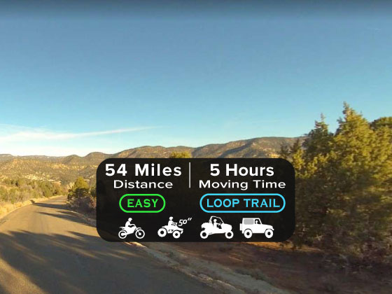
In this section, you will find keywords describing the trail’s skill level (Easy, Medium, Difficult), and if the trail is a loop, or if you will ride out and back along the same track. It also includes the types of terrain you will encounter, and the sizes of machines which are allowed. The time and distance represent how long and how far you will go from the trailhead and back.
Area Info
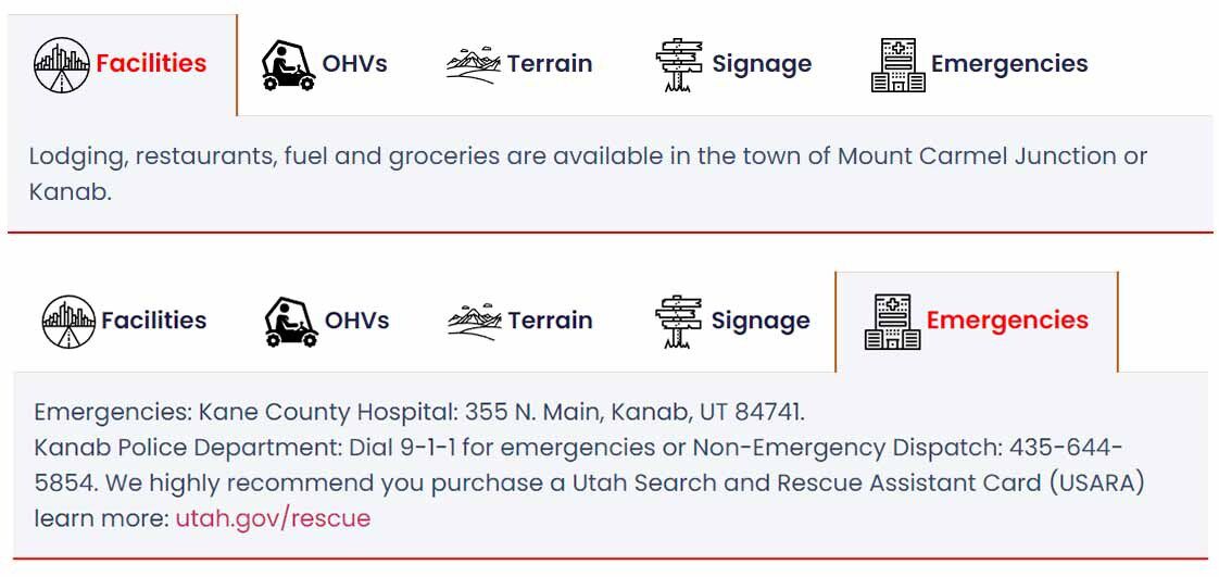
This section has important information about the local area around the trail. This includes lodging, gas stations, grocery stores, restaurants, and restrooms. There is also more detailed information about the terrain, trail markings, as well as the nearest contact for emergency services.
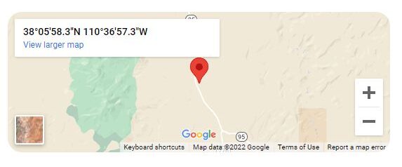
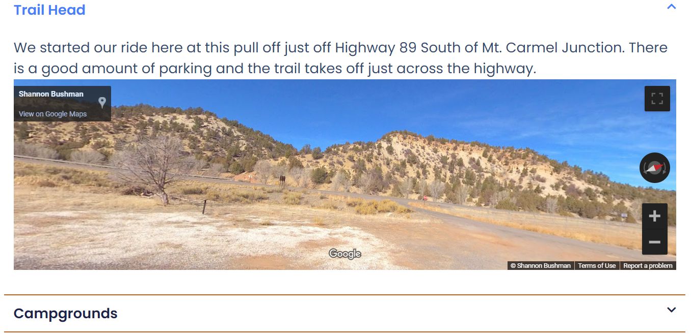
Trail Head Location
This link gives you directions to the trailhead. Please check the Trail Information section about trailhead parking, as not all trailheads can accommodate trailers.
Downloads
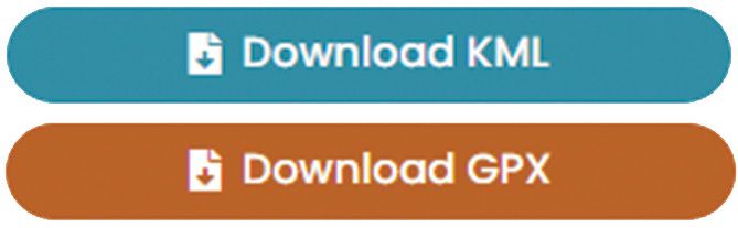
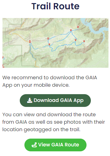
You can directly download the trail route in KML or GPX formats. This is useful if you use an app other than GAIA, or if you use an integrated GPS in your OHV to navigate.
Maps
Points Of Interest
This expandable menu gives you quick access to trailhead information, important intersections, signage, and points of interest along the trail.