Facilities
  OHVs
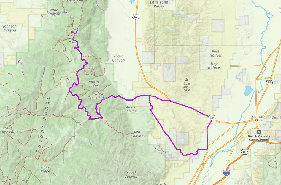
OHVs Terrain
 Signage
 Emergencies Facilities
 While there is parking at the trailhead and soon to be restrooms at West Park. The closest creature comforts are in Salina which is a short 4 miles from Aurora. There you can find a variety of fast food and sit down restaurants. There are several gas stations, the closest is the Maverick right in the center of town. We like to order chicken fried steak and Mom’s Restaurant.
OHVsThis trail is open to all forms of OHVs from full size to dirt bikes, and is an enjoyable ride for all of them. This route should accommodate adventure bikes nicely as well.
TerrainMostly climbing up graded gravel roads to an elevation just over 9000 feet. Some of the ridge trail is more along the line of two track routes.
SignageMajor intersections are marked with Forest Service route markers, but the rest is somewhat limited. Not hard to keep your bearing, but a downloaded map would be handy.
EmergenciesSheriff (435) 896-2600 for non-emergency. 9-1-1 for emergency
Emergency Medical Help: Sevier County EMS (435) 893-9166 or call 9-1-1
Emergency Medical Help: Sevier County EMS (435) 893-9166 or call 9-1-1
While there is parking at the trailhead and soon to be restrooms at West Park. The closest creature comforts are in Salina which is a short 4 miles from Aurora. There you can find a variety of fast food and sit down restaurants. There are several gas stations, the closest is the Maverick right in the center of town. We like to order chicken fried steak and Mom’s Restaurant.
This trail is open to all forms of OHVs from full size to dirt bikes, and is an enjoyable ride for all of them. This route should accommodate adventure bikes nicely as well.
Mostly climbing up graded gravel roads to an elevation just over 9000 feet. Some of the ridge trail is more along the line of two track routes.
Major intersections are marked with Forest Service route markers, but the rest is somewhat limited. Not hard to keep your bearing, but a downloaded map would be handy.
Sheriff (435) 896-2600 for non-emergency. 9-1-1 for emergency
Emergency Medical Help: Sevier County EMS (435) 893-9166 or call 9-1-1
Emergency Medical Help: Sevier County EMS (435) 893-9166 or call 9-1-1